Thankfully, in spite of the Government’s ridiculous impotence, the folks at the NOAA National Hurricane Center are still working. It’s been a light hurricane season, but we’re finally near the predicted path of tropical storm Karen, which may even be a hurricane by the time it gets to Louisiana. Looks like it might miss a direct hit on Baton Rouge, but it’ll go right through New Orleans and we’re sure to get some wind here. I’ve put up some graphics from the NHC’s site for today, showing landfall in southern LA sometime during early Saturday morning.

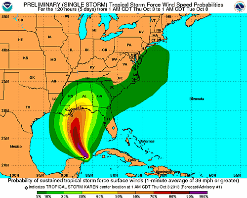
Here is the wind speed prediction graphic:
I’ll add updates as Karen gets a little closer. Karen never even made landfall, and then got depressed, and then disappeared.